Contents
Previous
Next

Export package for processing DRAO telescope data
Version : Nov-2001
Author(s) : L. Higgs
License : GPL
Website : http://www.drao.nrc.ca/
Disk space required for installation is 75.36 Mb
After the package is installed it can be accessed using the command
/opt/lfa/startdrao
A shortcut will be installed in the KDE/GNOME desktop menu system,
as an entry in the Astronomy submenu
Summary
DRAO export package.
26m_processing -- overview of data processing of 26 m spectra
87GB_catalog -- Information on the 87GB radio source catalog
abc -- structured FORTRAN preprocessor.
analyzerec -- determine statistical parameters for ranges of
elements
applications -- overview of DRAO astronomical application software
arch_fits -- create archival FITS files for DRAO or CGPS data
avspec -- shift, weight, scale and average spectra from various
spectral sets
avsrclist -- average, or statistically compare, "fluxfit" source
bestspec -- computes a spectral index map from several brightness
temperature
cdv -- program compile and link tool
checkbox -- check source box definitions in a DRAO box definition
comp_spec -- compute "stray radiation" corrections, using an
assumed
comp_vel_diff -- compute observer velocity wrt LSR for a given
confdb -- database for management of a small scientific meeting
conv_ang2rad -- convert angles in radians to angles in astronomical
conv_eq2azel -- convert current equatorial coordinates to azimuth
convert_leiden -- script to add a range of Leiden longitude samples
conv_gal2azel -- convert Galactic coordinates, at a given Modified
convints -- convert integer files to/from little endian (VAX and
DECstation) to big endian (IBM) format
conv_madr -- convert MADR/PLOT definition files to/from
conv_mjd2cal -- convert Modified Julian Date to Gregorian calendar
date
conv_mjd2lst -- convert Modified Julian Date to Local Sidereal
Time,
convolve -- smooth, convolve, or deconvolve an image
convreals -- convert real number files to/from VAX and IEEE formats
coverage -- access the database of DRAO (or GPS) observations
cr_hisky -- create a full sky true HI database from Leiden spectra
cr_stray_cb -- create databases useful for stray radiation analysis
cubesmooth -- smooth a data cube to a new resolution, by
cube_stat -- derive images of datacube statistical parameters
cubinterp -- interpolate or smooth a data cube onto a new Z grid
cutmap -- compute and extract slices from an image
diff_gps2spec -- derive difference spectra (and/or difference
diff_gpsspec -- derive difference spectra (and/or difference
diff_shift -- cross multiply and compute differences between two
dataset
dopcor -- compute Doppler velocity corrections
drao_ps -- update, list or summarize point source data in master
drao_surveys -- The DRAO Surveys area on the UNIX system
dumpfits -- program to search and/or list contents of FITS data
files
dump_madr -- diagnostic tool for looking at madr file definitions
edit_fits -- program to edit header records of a FITS data file
expandmap -- expand a map or maps to a larger image by smoothly
tapering
expandrec -- propagate a master spectrum record through a file or
family
feature -- delineate connected features in 2 D or 3 D databases
fileio -- specify parameters for data files
findsrc -- find sources in an image, and create a source box
fitline -- fit a linear or quadratic to a set of X,Y data points
fittwist -- fit a twisted plane to a file or family of files
fitxy -- compute line best fitting x,y data pairs when both
fix_cube -- check a spectral datacube for bad base levels, bad or
fluxfit -- compute flux densities of sources in a map
flxscale -- derive best fit scale factor between two sets of
FORCE -- structured FORTRAN programming language.
ft_regrid -- interpolate a spectral set onto a new
galcon -- convert galactic to equatorial coordinates or vice versa
galparm -- compute parameters for extragalactic radio sources
galrot -- calculate galactic rotation velocities
gaussmap -- add (subtract) model gaussians to (from) maps
gausspec -- fit Gaussians to (spectral) data in file(s)
gaussrec -- create synthetic Gaussian spectra for test purposes
gbflux -- list 87GB catalog data
gencon -- convert astronomical map coordinates to pixel
coordinates, and
gengps -- utility to generate coordinate parameters for CGPS fields
getmap -- display, using an IDL task, a GIF image of a contour
gps2_base -- adjust baselevels for CGPS spectra in the standard
CGPS
gps2_edit -- remove spectra from the main GPS Phase II observed
spectra
gps2extract -- extract a short spacing sub cube from the
gps2plan -- plan 26 m Telescope observations for CGPS Phase II
gps2_sum -- create a datacube of channel sums for a Phase II CGPS
26 m
gps_base -- adjust baselevels for CGPS spectra in the standard CGPS
gps_edit -- remove spectra from the main GPS observed spectra
gpsextract -- extract a short spacing sub cube from the
gpsplan -- plan 26 m Telescope observations for CGPS
gps_sum -- create a datacube of channel sums for a CGPS 26 m
gridnec -- create a full sky antenna pattern using data files
created
hdr_convert -- convert FITS header to/from binary/ASCII
hi_abs -- analyse a cube of HI data for self absorption (HISA)
features
hiimodel -- compute observational parameters for geometric models
of
hi_spike -- analyse a cube of HI data for near point like
absorption and/or
idl_imview -- subroutines to connect a normal DRAO
imview -- display, in an IDL window, files from selected
inspolcorr -- correct Q,U and V maps for instrumental polarization
interf_rep -- analyze 26 m Telescope interference log for GPS
irascompar -- compare fluxfit source list with IRAS
iras_point -- IRAS Point Source Catalog at DRAO
library -- help library manager and display utility.
linecorr -- apply self calibration corrections to line data
listcnvrt -- convert coordinates of sources in a source list
listgps -- utility to list coordinate parameters related to
madr -- the DRAO data Manipulation And Display package
makebeam -- create a full sky antenna pattern using geometric
elements,
makelist -- create a fluxfit type source list file
makepolmap -- create polarized intensity and
map2uvp -- convert an image to its UV plane counterpart or vice
versa
mapbias -- remove a constant offset from a map or family of maps
mapcomb -- combine images or maps together onto a common grid
system
mapconvrt -- convert maps from one coordinate system to another
maptaper -- taper the edges, or regions beyond a given pixel
radius,
matchgb -- find, given source positions, matching sources
meanlev -- compute the average map value over specified regions,
useful
modmatch -- find average map values within designated
mosconv -- convolve a mosaic image, with a resolution datacube, to
necscript -- a script to control NEC calculations of antenna
pattern
newcube -- display, using an IDL task, a DRAO data cube specified
by
ph2 -- Fourier transform UV visibility data to the image (sky)
domain
pie -- compute radial averages in pie sectors over a map
plot_26m -- produce PLOT type x/y plot file for parameters in
plot -- the DRAO publication quality plotting package
plotspec -- extract a spectrum and convert to XY plot format
polanal -- analyse polarization maps
polarcorr -- correct images for attenuation due to polar diagram
polartile -- combine images or datacubes by tiling (mosaicing), in
polenhance -- enhance polarized emission maps for use with PLOT
polyfit -- fit polynomial baselines to spectra in a spectral set
polygbase -- create base levels in images using polygons
polygmsk -- mask maps using polygons or pre defined masks
prt -- print ascii files to QMS laser printers (or system printer)
ptsrcs -- compute model visibilities and do self calibration of uv
data
QU_convert -- convert Q/U maps from one position angle reference
frame
radphys -- compute physical quantities related to HII regions
rfits -- program to read FITS data files from disk
seerec -- display on terminal selected records from a file
selectgb -- select subsets of the 87GB radio source catalog
sightline -- derive elevation profiles or deviations from
sightlines,
sldepress -- derive minimum depression below sightlines from
transmitter
solve_antgeom -- solves antenna geometry conversions between
antenna pattern
solve_triang -- solves for the sides and angles of a spherical
sourcecomp -- compare flux densities of sources in two lists
specindex -- computes spectral index maps, T T plots, or makes
spec_interp -- interpolate or smooth a spectral set onto a new
specmap -- computes a spectral index map by doing a TT plot
specsmooth -- smooth selected spectra in a spectral set
specview -- display, in an IDL window, spectral data files
sp_extract -- extract averaged or single spectra from a datacube
spher_wave -- compute properties of the Bonn design feed used on
splinefit -- smooth records (spectra) or fit base levels in a
dataset
srccount -- compute source counts
stray_rad -- overview of stray radiation analysis software for
sunpos -- compute non Sun up times for Synthesis Telescope
observations
supertile -- combine images or datacubes by tiling (mosaicing)
survey -- extract an image from a survey database
texas -- list Texas Survey catalog data
texcompar -- compare source list with Texas Survey sources
to_stokes -- Convert DRAO 21 cm continuum visibilities to Stokes
format
uvanalyze -- analyze gridded UV plane data arrays
uvmodel -- create UV amplitude and phase distributions for given
errors
vlabase -- compute VLA baseline parameters
wfits -- writing FITS disk files
wtmean -- compute the weighted mean of a series of data values (and
xyextract -- extract sub map(s) from large map(s), adjusting
zeroboxes -- zero (or set to no data) areas of an image defined
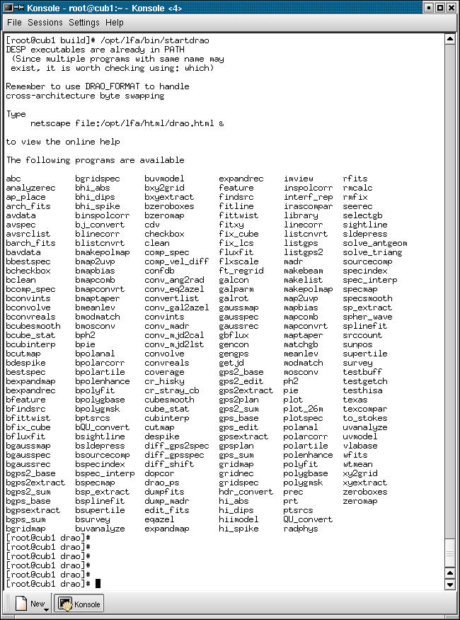
Screenshots
Contents
Previous
Next